


 8:00 PM
 J-Mad
J-Mad

Today was the Ecuadorian Independence Day (August 10th). Instead of staying in Quito to do something, fourteen of us from work hired a driver and a van to take us to the Cotopaxi National Park for the day. We left around 8:30am and arrived a few hours later.

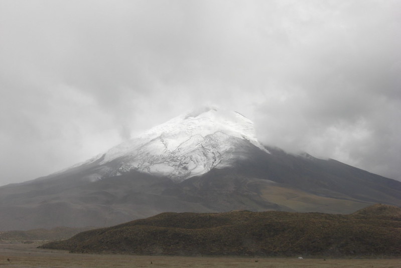
The park sits at an elevation even higher than Quito so you could feel the air becoming thinner as we drove through the park to go to the parquedero to start the trek. It is amazing too to see the geographical changes in the landscape in Ecuador. Quito is dry and dusty but outside the city is lush and green, especially as you drive to lower elevations. Quito is also nestled between mountain ranges in the Sierra, but the Cotopaxi National Park was completely different. Generally, it was very flat (except for Cotopaxi and some other volcanos) and the ground was hard, dry, and gravely with the volcanic rocks.
When we got to the parquedero to start our trek, our driver told us that he would wait for us at the bottom because he is prone to altitude sickness. He instructed us to walk extremely slowly and take as many breaks as needed to avoid feeling sick. He instructed the smokers in our group to refrain from smoking because that makes the altitude sickness worse. With these words of encouragement, we were off.
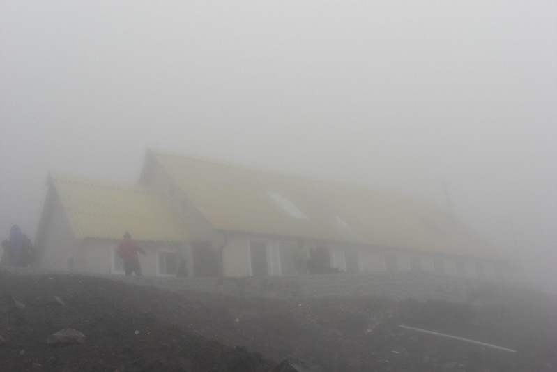 | |
| Refugio Jose Rivas |
For reference, Quito sits at 9,350 feet above sea level (2,849 meters). Prior to hiking on Cotopaxi, the highest I had been was to the TeleferiQo in Quito that starts at 10,006 feet above sea level (3,050 meters) and ends at 13,287 feet (4,050 meters). The parquedero at Cotopaxi where we started our hike was located at 15,091 feet above sea level (4,600 meters) and our destination, the Jose Rivas Refugio, is located at 15,953 feet (4,864 meters). In contrast to all of this, my hometown in the U.S.A. is located at a mere 650 feet above sea level (198 meters).
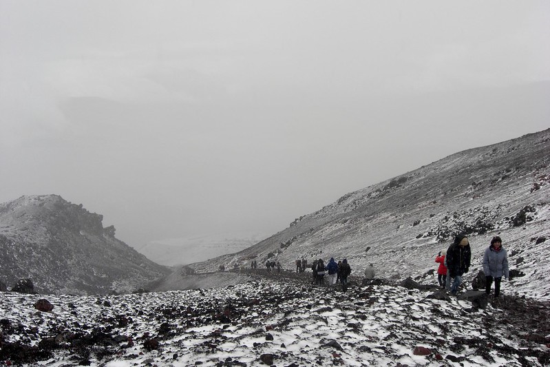
We all felt the altitude to varying degrees. A friend and I hiked up together, stopping along the way to catch our breaths and take pictures (fun and a good excuse to walk slower and rest more). The hike up was not technically tough, aside from the thin air, but the volcanic gravel was not very stable and it was sort of like climbing a really, really tall sand dune. The fog was also very thick. I could not see much past my hand when I held it out at arm's length. We knew that the edges of the trail dipped off into steep ravines, so we kept following the people in front of us in one direction: up. About halfway between the parquedero where we started and the refugio, I started getting the same kind of nautious feeling as motion-sickness in a car and the last ten minutes of our hike had a few of us feeling light-headed too. Although the refugio is actually not that far away, the combination of the high altitudes and wet gravel meant it took us about an hour and twenty minutes to make it to our destination.
Once at the refugio, we all felt great. We bought some delicious hot chocolate (I feel so sorry for the people who have to haul supplies up and down from the refugio - although they must have the best lungs in the world). It was great resting there even though it was also pretty cold, and we met some other travelers, including a French woman who had hiked to the top! A few people in our group left the refugio to try to walk another twenty minutes up to see where the ice starts, but there was a pretty bad storm higher up, so park rangers would not let people pass for safety concerns.
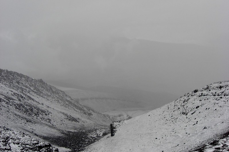
When we left the refugio to hike back down, it had started snowing! It was a strange snow - more like a cross between snow and hail. It reduced some of the fog though meaning we could see around and down from us better. The white snow covering the black, grey, and red gravel was beautiful. I thought Cotopaxi was so much prettier in the snow. It was cold and all we had were sweatshirts and thin windbreakers, but I really enjoyed taking my time walking down to take in the beauty of the mountain around me. It was so much easier walking down than climbing up. Where the gravel had been slippery and unstable hiking up, we were able to slide down quickly. It was pretty fun and only took us about 20 minutes to come down from the refugio to our van in the parquedero.
After our mini-trek, we went to the laguna in the park. The water level was very, very low, but apparently it is a great place to see different bird species. We saw a couple, then moved on to another section of the park to look at the changed landscape before returning back to Quito. I think this was one of my favorite trips in Ecuador thus far and someday, it would be really cool to sumit a mountain (not anything crazy-tall, but maybe see if I can go further than the altitude where we were at the refugio).
 Posted in:

0 comments:
Post a Comment